Evolvement LLC logo

Drone Data: Air, Space, and Sea

Real-time drone data collection while in flight, including GPS, latitude, longitude, altitude, flight path, payload, wind speed, propeller speed, AI Vision, AI video, environmental sensors, Cosmos streaming, PostgreSQL scoring, maps, and automations.

What We Build

  • Real-time drone telemetry ingestion for latitude, longitude, altitude, flight path, speed, heading, cardinality, payload weight, accessories, propeller speed, battery, and wind speed.
  • GPS and satellite-aware flight tracking that connects to the same satellite navigation context used by the drone for location, heading, time, and path reconstruction.
  • AI Vision and AI Video streaming feeds that detect objects, count assets, estimate size and shape, evaluate colors, classify activity, and stream references into Cosmos DB.
  • Environmental and sea sensor integration for water depth, sunlight frequencies, wave height, temperature, wind, bandwidth, spectrum, frequency, and other mission-specific readings.
  • PostgreSQL scoring models for risk, confidence, environmental thresholds, flight safety, object detection, mission scoring, and operational recommendations.

Example Use Cases

  • Track a drone in flight with real-time map overlays, path replay, altitude, speed, heading, and GPS satellite context.
  • Stream AI video frames into Cosmos while storing scores, vectors, confidence, and risk outputs in PostgreSQL.
  • Monitor water depth, wave height, sunlight frequencies, wind, temperature, and sea-state conditions during air or maritime missions.
  • Trigger automations when thresholds are exceeded, including reroute recommendations, operator approval, Teams alerts, and dashboard updates.
  • Combine air, space, and sea data into one operational picture for mission awareness and post-flight analysis.

Drone Data Collection Approach

Drone operations create rich real-time data. Evolvement LLC can integrate telemetry, camera feeds, AI Vision, GPS/satellite context, sensor readings, environmental data, and scoring models into dashboards and automation workflows. The platform can collect data while the drone is in flight, stream operational records into Cosmos DB, score data in PostgreSQL, and display results through maps, dashboards, and mission timelines.

  • Flight Telemetry: latitude, longitude, altitude, flight path, heading, cardinality, speed, battery, propeller speed, payload, accessories, and wind speed.
  • GPS / Satellite: connect drone navigation context to the same GPS/satellite reference used by the drone for path and time alignment.
  • AI Vision / Video: classify objects, estimate counts, detect shapes, measure size, evaluate colors, and stream video metadata into Cosmos.
  • Environmental: water depth, sunlight frequencies, wave height, temperature, spectrum, bandwidth, frequency, and sea/air conditions.
  • Scoring and Automations: PostgreSQL scoring, AI agents, threshold workflows, dashboard alerts, reroute recommendations, and approved actions.

Drone Data Examples

The screenshots below are packaged locally with this page so they render reliably. They show real-time telemetry, GPS/satellite links, flight path maps, AI video, Cosmos ingestion, PostgreSQL scoring, environmental sensors, automations, and architecture.
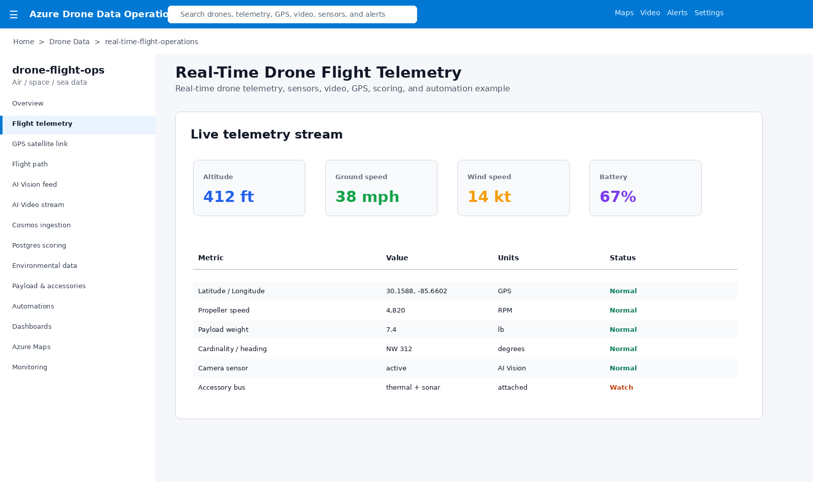
Drone real-time telemetry

Real-Time Flight Telemetry

Live drone telemetry includes altitude, speed, wind, battery, latitude/longitude, propeller speed, payload, accessories, camera sensors, and heading.
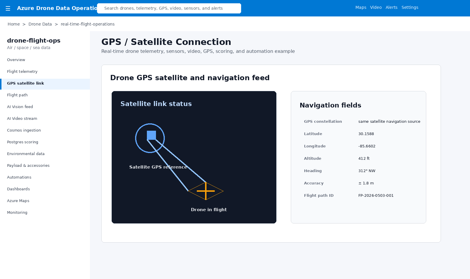
Drone GPS satellite link

GPS / Satellite Connection

Drone location and flight path can be aligned to the same satellite navigation context used by the aircraft.
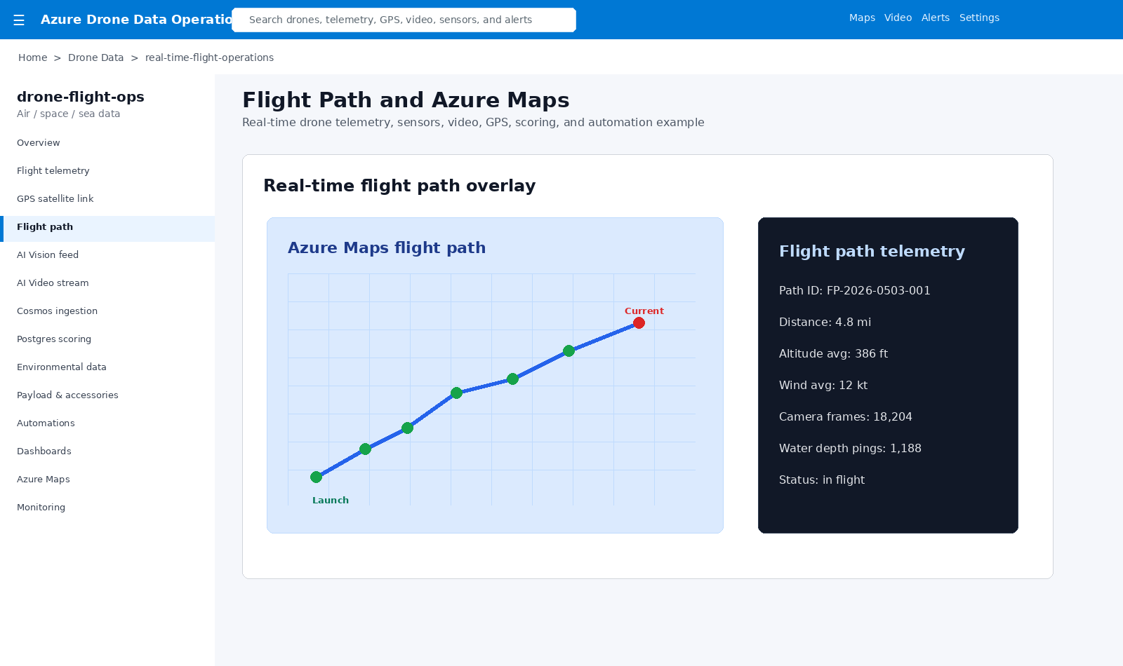
Drone flight path map

Flight Path and Azure Maps

Map overlays show launch point, current location, route history, distance, altitude, wind, camera frames, and water-depth pings.
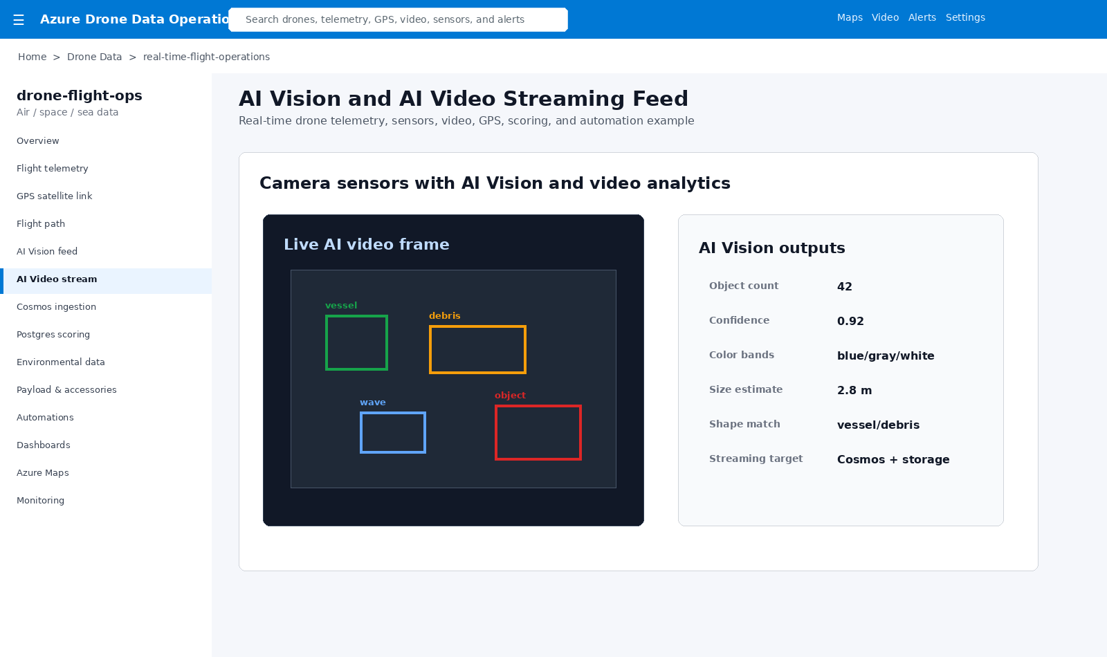
Drone AI Vision video stream

AI Vision and Video Streaming

AI Vision detects objects, counts assets, estimates color, size, and shape, and streams video references into Cosmos.
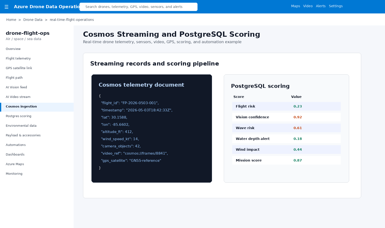
Drone Cosmos and PostgreSQL scoring

Cosmos Streaming and PostgreSQL Scoring

Telemetry and video references stream into Cosmos while PostgreSQL stores risk, confidence, environmental, and mission scores.
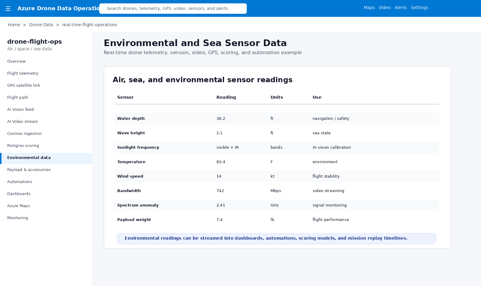
Drone environmental sea sensors

Environmental and Sea Sensors

Water depth, wave height, sunlight frequencies, temperature, wind, bandwidth, spectrum, and payload readings support mission awareness.
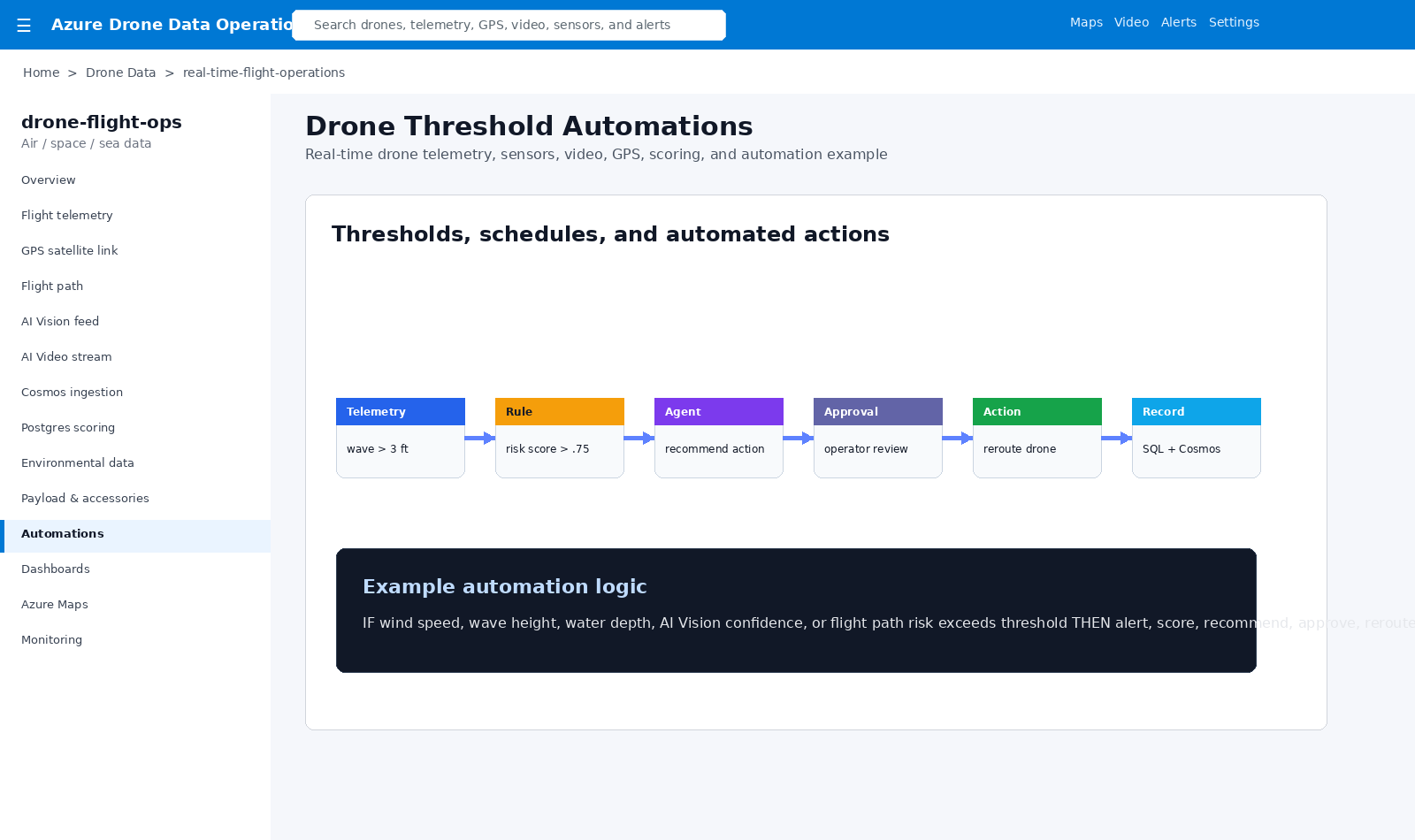
Drone threshold automations

Threshold Automations

Thresholds and AI scores can trigger alerts, operator approvals, reroutes, SQL updates, Cosmos writes, and dashboards.
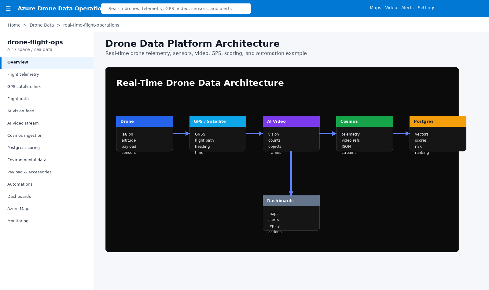
Drone data architecture

Drone Data Architecture

Drone telemetry, GPS/satellite context, AI video, Cosmos, PostgreSQL scoring, dashboards, and automations work together.

Architecture Flow

Drone

Telemetry, payload, accessories, propellers, camera sensors, AI video, GPS, and environmental readings.

Satellite / GPS

Flight path, latitude, longitude, altitude, heading, cardinality, timing, and route alignment.

Stream

Cosmos DB, video references, JSON telemetry, AI Vision metadata, and sensor readings.

Score

PostgreSQL risk scoring, confidence, mission quality, environmental thresholds, and recommendations.

Act

Maps, dashboards, alerts, reroute recommendations, approvals, SQL updates, and automations.

This pattern turns in-flight drone telemetry and sensor feeds into real-time operational intelligence. Data is collected during flight, aligned to GPS and satellite context, enriched with AI Vision, streamed into Cosmos, scored in PostgreSQL, and displayed through maps, dashboards, and automated workflows.

Business Value

  • Real-time situational awareness while drones are in flight.
  • Integrated air, space, and sea data using telemetry, GPS, AI Vision, and environmental sensors.
  • Traceable data storage through Cosmos records and PostgreSQL scoring outputs.
  • Faster operational response through threshold-based alerts and automations.
  • Post-flight replay, mission scoring, environmental trend analysis, and dashboard reporting.

Example Production Flow

  • Drone launches and streams GPS, telemetry, AI video, and sensor readings.
  • Flight path aligns to satellite/GPS context and maps.
  • Cosmos stores JSON telemetry, video references, and AI Vision outputs.
  • PostgreSQL stores scoring, vectors, confidence, and risk metrics.
  • Dashboards show path, status, environmental data, and mission health.
  • Thresholds trigger alerts, reroute recommendations, approvals, and action workflows.
Back to Capabilities